

The Lake Anna area is experiencing a drought that began in early August. While we have seen several minor episodes of rain, none have been enough to bring us back to normal levels. The rainfall deficit continues to grow across the region. Typically, we receive about 12 inches of rain from August through mid-November, but this year we have seen only about 5 inches—roughly 7 inches below normal. As of Nov. 15, the current drought status ranges from moderate to severe.
One saving factor is that temperatures since August have been running a few degrees below normal, slowing evaporation rates. Had temperatures been typical for August and September, our drought status would be worse.
Droughts are defined by comparing past rainfall to normal rainfall over a specific time period. The National Drought Mitigation Center, the Department of Agriculture, and the National Weather Service (NWS) jointly track rainfall across all 50 states and issue weekly drought updates. The latest update for Virginia is available at this link: https://droughtmonitor.unl.edu/CurrentMap/StateDroughtMonitor.aspx?VA
Although most of this drought has occurred outside the main growing season, continued dry weather could still cause significant problems. Groundwater, lakes, streams and rivers could fall to levels that lead to water shortages. Boating on Lake Anna will require greater awareness of shallow areas, especially locations where large boulders or rocks are normally several feet below the water line. Some typically shallow areas no longer have enough water to allow boats to enter the lake. Lake Anna is currently about 20 inches below the normal full-pool level of 250 feet above mean sea level.
There is also increased concern about wildfire spread. Vegetation is much drier this time of year, fallen leaves cover the ground, and stronger storms often bring windy days with low humidity. Windy, dry conditions may prompt the NWS to issue wildfire alerts, and if conditions worsen, the state may issue a ban on outdoor burning.
The NWS issues two fire-weather products to the public. A Fire Weather Watch is issued when the following conditions are expected the next day:
Either, surface winds in excess of 25 mph, relative humidity of 30% or less, and 10-hour fuel moisture less than 8%.
Or, surface winds in excess of 35 mph.
A Red Flag Warning is issued when these conditions are expected within 24 hours.

I grew up an Air Force Brat. Traveled the country and lived in Georgia, Maine, New York, Hawaii and Oklahoma.
I fell in love with the weather in Oklahoma. My father was transferred to Tinker AFB in 1973. While in Temporary housing (a mobile home, which is the standard in Oklahoma) I experienced my first severe thunderstorm with strong winds and hail the size of baseballs. The next day I was in the base library looking up books on weather. The rest is history.
I graduated from the University of Oklahoma in 1983 with a Bachelor’s Degree in Meteorology. The first two years we took Calculus, Differential equations, Physics, Chemistry and Computer science classes with the Engineering Students. It was a grind. My degree is actually from the College of Engineering. The last 2-3 year’s focus was on Meteorology including Observational networks (Satellite, Radar, Surface), Physics, Thermodynamics, Dynamics, Synoptic, Winter Weather, Severe Weather and Climatology.
My first job out of college was with a small forecasting company in Oklahoma City. I was immediately put on TV (OETA) and Radio (WKY) as their broadcast Meteorologist. After two years in broadcasting, I decided to pursue the National Weather Service route and got a position in Toledo, OH as an intern. After a couple of years, I was promoted to a forecaster position at the Cleveland Forecast office. I quickly moved into the Weather Preparedness position and was responsible for all the preparedness activities in the state of Ohio.
In 1992 I decided to pursue other forecast opportunities and moved to the Meteorological Operations Division of the National Meteorological Center in Washington, DC. This group is now called WPC (Weather Prediction Center). There I fine-tuned my forecasting of Synoptic Weather with my focus on Heavy Convective Rainfall and Winter Storms, under the supervision of Dr. Louis Uccellini. He has written several books on East Coast Winter storms. I was promoted to a Senior Branch Forecast position during my tenure at MOD. Part of my job was to teach weather classes at COMET (Cooperative Program for Operational Meteorology, Education, and Training).
In 2012 I was given the opportunity to start up a new weather support group with the FAA (Federal Aviation Administration) in Warrenton, VA at the ATCSSC (Air Traffic Control System Command Center). The ATCSCC is where the FAA identifies solutions to air traffic inefficiencies in the NAS (National Air Space) for the CONUS (Continental United State). Weather impacts are the biggest impact on Aviation with yearly losses over 20 billion dollars. My job was to help lower these inefficiencies/costs by providing weather impact briefings and forecasts in order to keep the air planes moving as safely and efficiently as possible.
I retired in 2022 and now am running Lake Anna Weather, LLC.
Subscribe for Updates
Sponsors


latest articles
November 26, 2025
Letter from the Editor: Grateful for Our Students

November 26, 2025
New Rotary Charter Lights Up Patriotism with Flags for Heroes

November 26, 2025
Lake Anna Region Faces Moderate to Severe Drought
November 26, 2025
Powering the Lighted Boat Parade: Leaders Behind the Lights

November 26, 2025
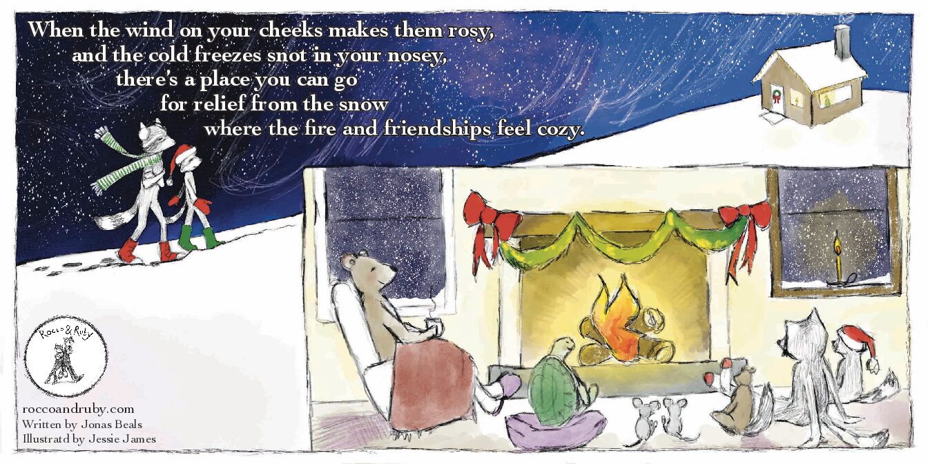
Rocco & Ruby
November 26, 2025
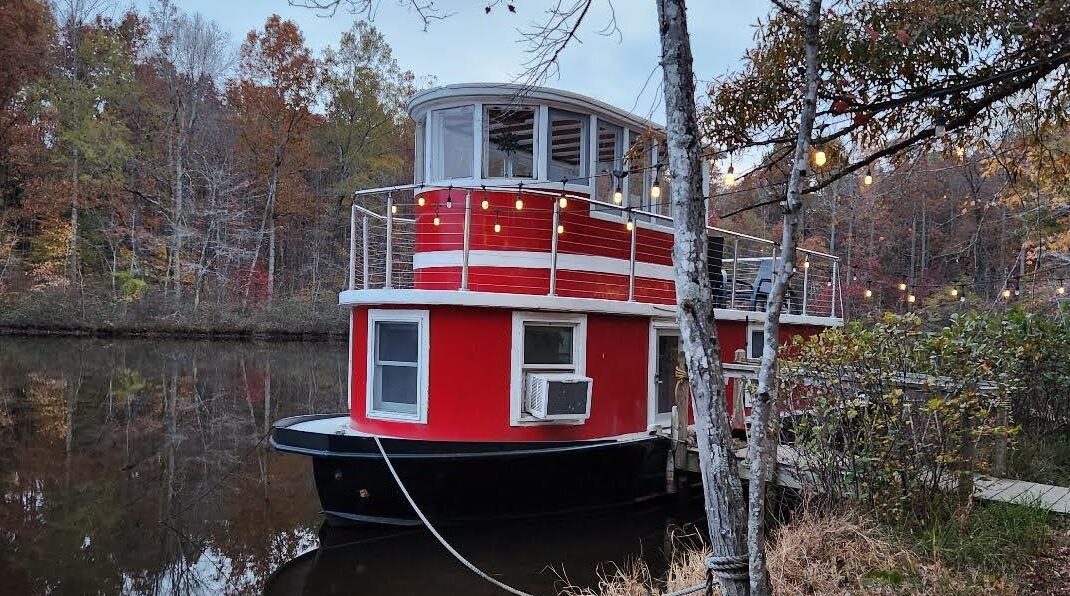
Travel: Sleep in a Tugboat, Wander to Waterfalls at Lake Glen Haven
The Lake Anna area is experiencing a drought that began in early August. While we have seen several minor episodes of rain, none have been enough to bring us back to normal levels. The rainfall deficit continues to grow across the region. Typically, we receive about 12 inches of rain from August through mid-November, but this year we have seen only about 5 inches—roughly 7 inches below normal. As of Nov. 15, the current drought status ranges from moderate to severe.
One saving factor is that temperatures since August have been running a few degrees below normal, slowing evaporation rates. Had temperatures been typical for August and September, our drought status would be worse.
Droughts are defined by comparing past rainfall to normal rainfall over a specific time period. The National Drought Mitigation Center, the Department of Agriculture, and the National Weather Service (NWS) jointly track rainfall across all 50 states and issue weekly drought updates. The latest update for Virginia is available at this link: https://droughtmonitor.unl.edu/CurrentMap/StateDroughtMonitor.aspx?VA
Although most of this drought has occurred outside the main growing season, continued dry weather could still cause significant problems. Groundwater, lakes, streams and rivers could fall to levels that lead to water shortages. Boating on Lake Anna will require greater awareness of shallow areas, especially locations where large boulders or rocks are normally several feet below the water line. Some typically shallow areas no longer have enough water to allow boats to enter the lake. Lake Anna is currently about 20 inches below the normal full-pool level of 250 feet above mean sea level.
There is also increased concern about wildfire spread. Vegetation is much drier this time of year, fallen leaves cover the ground, and stronger storms often bring windy days with low humidity. Windy, dry conditions may prompt the NWS to issue wildfire alerts, and if conditions worsen, the state may issue a ban on outdoor burning.
The NWS issues two fire-weather products to the public. A Fire Weather Watch is issued when the following conditions are expected the next day:
Either, surface winds in excess of 25 mph, relative humidity of 30% or less, and 10-hour fuel moisture less than 8%.
Or, surface winds in excess of 35 mph.
A Red Flag Warning is issued when these conditions are expected within 24 hours.
I grew up an Air Force Brat. Traveled the country and lived in Georgia, Maine, New York, Hawaii and Oklahoma.
I fell in love with the weather in Oklahoma. My father was transferred to Tinker AFB in 1973. While in Temporary housing (a mobile home, which is the standard in Oklahoma) I experienced my first severe thunderstorm with strong winds and hail the size of baseballs. The next day I was in the base library looking up books on weather. The rest is history.
I graduated from the University of Oklahoma in 1983 with a Bachelor’s Degree in Meteorology. The first two years we took Calculus, Differential equations, Physics, Chemistry and Computer science classes with the Engineering Students. It was a grind. My degree is actually from the College of Engineering. The last 2-3 year’s focus was on Meteorology including Observational networks (Satellite, Radar, Surface), Physics, Thermodynamics, Dynamics, Synoptic, Winter Weather, Severe Weather and Climatology.
My first job out of college was with a small forecasting company in Oklahoma City. I was immediately put on TV (OETA) and Radio (WKY) as their broadcast Meteorologist. After two years in broadcasting, I decided to pursue the National Weather Service route and got a position in Toledo, OH as an intern. After a couple of years, I was promoted to a forecaster position at the Cleveland Forecast office. I quickly moved into the Weather Preparedness position and was responsible for all the preparedness activities in the state of Ohio.
In 1992 I decided to pursue other forecast opportunities and moved to the Meteorological Operations Division of the National Meteorological Center in Washington, DC. This group is now called WPC (Weather Prediction Center). There I fine-tuned my forecasting of Synoptic Weather with my focus on Heavy Convective Rainfall and Winter Storms, under the supervision of Dr. Louis Uccellini. He has written several books on East Coast Winter storms. I was promoted to a Senior Branch Forecast position during my tenure at MOD. Part of my job was to teach weather classes at COMET (Cooperative Program for Operational Meteorology, Education, and Training).
In 2012 I was given the opportunity to start up a new weather support group with the FAA (Federal Aviation Administration) in Warrenton, VA at the ATCSSC (Air Traffic Control System Command Center). The ATCSCC is where the FAA identifies solutions to air traffic inefficiencies in the NAS (National Air Space) for the CONUS (Continental United State). Weather impacts are the biggest impact on Aviation with yearly losses over 20 billion dollars. My job was to help lower these inefficiencies/costs by providing weather impact briefings and forecasts in order to keep the air planes moving as safely and efficiently as possible.
I retired in 2022 and now am running Lake Anna Weather, LLC.
Subscribe for Updates
Sponsors

latest articles
November 26, 2025
Letter from the Editor: Grateful for Our Students
November 26, 2025
New Rotary Charter Lights Up Patriotism with Flags for Heroes
November 26, 2025
Lake Anna Region Faces Moderate to Severe Drought
November 26, 2025
Powering the Lighted Boat Parade: Leaders Behind the Lights
November 26, 2025
Rocco & Ruby
November 26, 2025
Travel: Sleep in a Tugboat, Wander to Waterfalls at Lake Glen Haven
Spotsylvania Tourism Growth Outpaces Statewide Averages with 35% Surge Since 2019
SPOTSYLVANIA COUNTY, VA — Visitor spending in Spotsylvania County has soared nearly 35% since 2019, reflecting a strong rebound and…
Article By Jen Bailey
![Featured image for “[Spotsylvania] New Speed Enforcement in School Zones”](https://lakeanna.online/wp-content/uploads/2025/09/Blog-pic-scaled.jpg)
[Spotsylvania] New Speed Enforcement in School Zones
To curb speeding and improve student safety, Spotsylvania officials have announced the launch of an automated speed enforcement program in…
Article By Jen Bailey
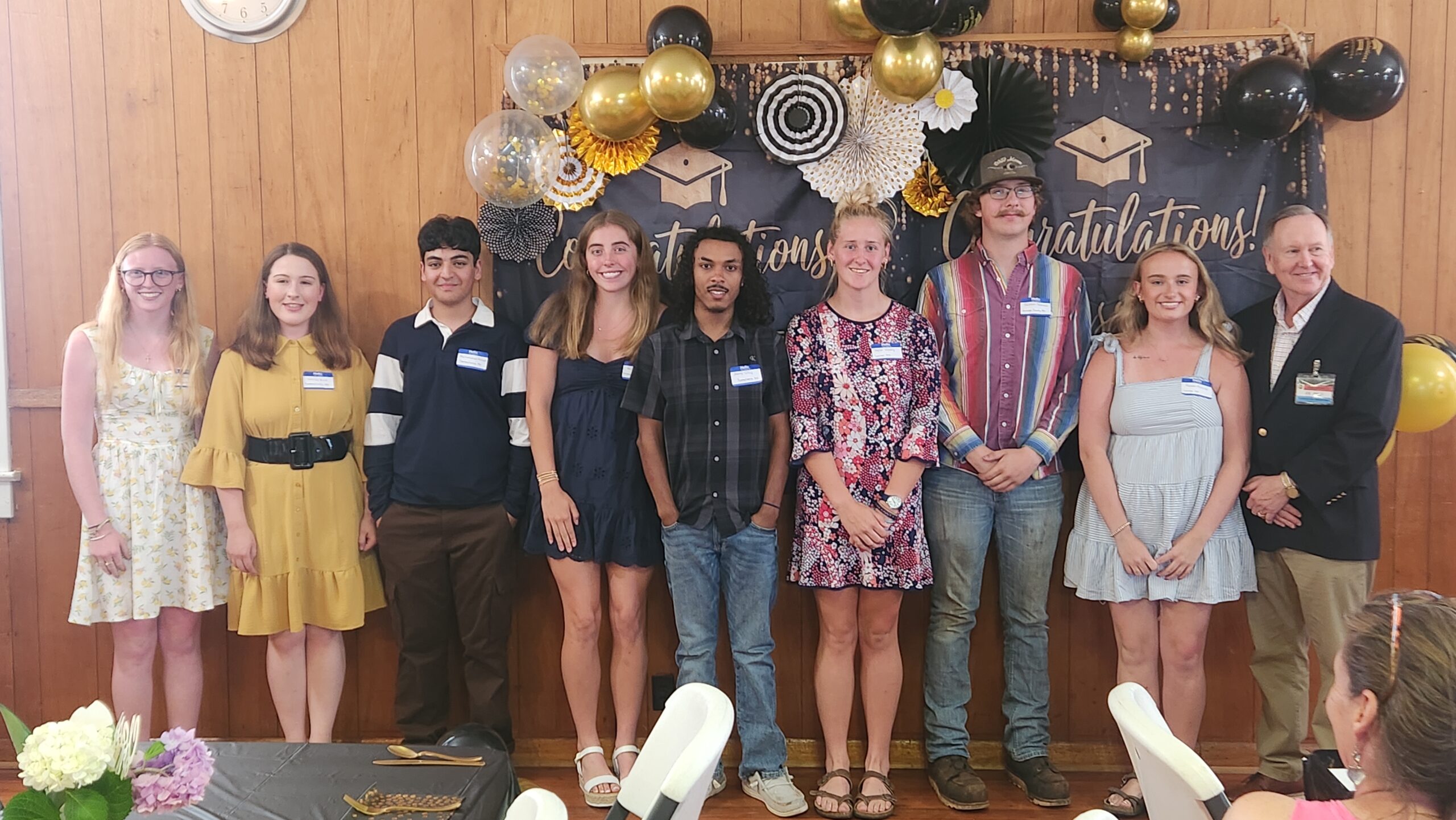
Belmont Ruritan Clubs Award $26,000 in Scholarships to Local Seniors
Thirteen outstanding seniors from Louisa, Orange, and Spotsylvania counties were recognized Tuesday evening, June 3, as the Belmont Ruritan Club…