
Heavy convective (thunderstorm) rainfall was my expertise for over half of my National Weather Service career. The technical term was called Quantitative Precipitation Forecasting (QPF), which in layman’s terms was trying to figure out how much rain would fall in a specific time period, in a specific location. The scope of our forecast area was the lower 48 states, including parts of Mexico and Canada, where rainfall runoff impacts rivers in the USA.
During the spring, we begin to see an increase in the number of thunderstorms, which can produce intense periods of heavy rain. One to two inches of rain in an hour is common from thunderstorms, and they can produce much more than that in extreme events.
There are two types of flooding that we need to be watchful for in the Lake Anna area: River flooding and Flash Flooding. River floods usually develop from relatively long periods of heavy rain and can cover large regions. When heavy rain occurs, some water will soak into the soil, with the rest flowing into rivers. The National Weather Service (NWS) makes rainfall forecasts out to five days and this data is fed into computer models of the rivers. Meteorologists at the Weather Prediction Center produce these forecasts.
After rainfall forecasts are put into river models, the output tells us how high the rivers and streams in the area will rise. In order to verify and track these forecasts the United States Geological Survey (USGS) operates numerous gauges along rivers throughout Virginia that record river heights.
The NWS knows the river heights that cause flooding near the gauge. If the NWS sees a potential for heavy rain to occur, that could push a river up to flood stage, then a flood watch is issued. If we have high confidence that the river will equal or exceed the flood stage, then a flood warning is issued. The gauge closest to the Lake anna area is on the North Anna River, at Partlow, just below the dam.
Fortunately, forecasting river flooding is fairly predictable and watches and warnings usually have enough lead-time so that people can move themselves and their property to higher ground before the water rises too high.
Flash flooding is a type of flooding that is very dangerous and results in more lost lives each year, in the United States, than any other weather phenomena. Flash flooding occurs when intense rains occur in a very short period of time so that the ground can’t absorb the water. Although flash floods usually evolve into river floods, the bigger danger is the rapid rise in water in small streams, creeks, runs and drainage ditches during the intense rainfall. During intense periods of heavy rain, the water in small water drainage areas can rise several feet in a matter of minutes. This results in fast flowing water that can carry cars and people quickly downstream and even wash away buildings in the biggest flash floods. The most serious flash floods usually occur in mountainous areas. The sloped terrain creates even greater runoff and faster rises in streams and rivers. This is what happened in June 1995 in Madison County when rainfall of 20-30 inches fell in about 16 hours. This gets a bit technical, but is a great overview of the Madison County Flash Flood.
There are some things that you can do to protect yourself from flash floods. The first is “DON’T EVER DRIVE YOUR CAR THROUGH WATER THAT’S RUNNING OVER A ROAD”. The danger lies in the fact that the water can eat away at the road and you really don’t know the depth of the water or if the road is washed away. It only takes about 18 inches of water to carry away most cars we drive today. About half of all flash flood deaths are from people in cars that get trapped in flash floods. If you ever come across this situation, “TURN AROUND DON’T DROWN.” Flash floods at night are even more dangerous since your visibility is reduced.
I grew up an Air Force Brat. Traveled the country and lived in Georgia, Maine, New York, Hawaii and Oklahoma.
I fell in love with the weather in Oklahoma. My father was transferred to Tinker AFB in 1973. While in Temporary housing (a mobile home, which is the standard in Oklahoma) I experienced my first severe thunderstorm with strong winds and hail the size of baseballs. The next day I was in the base library looking up books on weather. The rest is history.
I graduated from the University of Oklahoma in 1983 with a Bachelor’s Degree in Meteorology. The first two years we took Calculus, Differential equations, Physics, Chemistry and Computer science classes with the Engineering Students. It was a grind. My degree is actually from the College of Engineering. The last 2-3 year’s focus was on Meteorology including Observational networks (Satellite, Radar, Surface), Physics, Thermodynamics, Dynamics, Synoptic, Winter Weather, Severe Weather and Climatology.
My first job out of college was with a small forecasting company in Oklahoma City. I was immediately put on TV (OETA) and Radio (WKY) as their broadcast Meteorologist. After two years in broadcasting, I decided to pursue the National Weather Service route and got a position in Toledo, OH as an intern. After a couple of years, I was promoted to a forecaster position at the Cleveland Forecast office. I quickly moved into the Weather Preparedness position and was responsible for all the preparedness activities in the state of Ohio.
In 1992 I decided to pursue other forecast opportunities and moved to the Meteorological Operations Division of the National Meteorological Center in Washington, DC. This group is now called WPC (Weather Prediction Center). There I fine-tuned my forecasting of Synoptic Weather with my focus on Heavy Convective Rainfall and Winter Storms, under the supervision of Dr. Louis Uccellini. He has written several books on East Coast Winter storms. I was promoted to a Senior Branch Forecast position during my tenure at MOD. Part of my job was to teach weather classes at COMET (Cooperative Program for Operational Meteorology, Education, and Training).
In 2012 I was given the opportunity to start up a new weather support group with the FAA (Federal Aviation Administration) in Warrenton, VA at the ATCSSC (Air Traffic Control System Command Center). The ATCSCC is where the FAA identifies solutions to air traffic inefficiencies in the NAS (National Air Space) for the CONUS (Continental United State). Weather impacts are the biggest impact on Aviation with yearly losses over 20 billion dollars. My job was to help lower these inefficiencies/costs by providing weather impact briefings and forecasts in order to keep the air planes moving as safely and efficiently as possible.
I retired in 2022 and now am running Lake Anna Weather, LLC.
Subscribe for Updates
Sponsors


latest articles
April 21, 2026
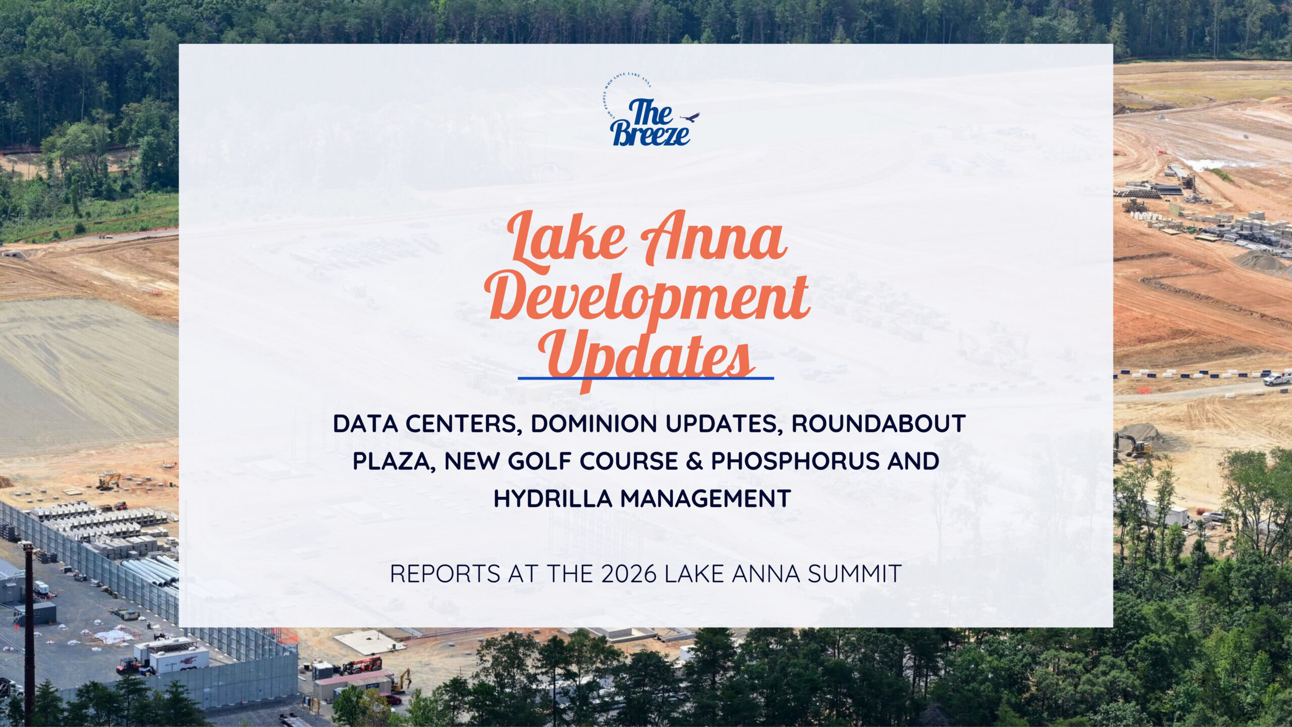
Lake Anna Development Continues: Data Centers, Dominion Updates, Roundabout Plaza, New Golf Course & Phosphorus and Hydrilla Management Reports at the 2026 Lake Anna Summit
April 18, 2026
From Louisa County to Hospital Halls: How Virginia Poodles & Doodles Is Making a Broader Impact

April 15, 2026
Lake Anna Waterfront Property | Custom Lake Home for Sale | Lake Anna, VA
March 18, 2026
Puppy Culture, Playgrounds & Early Foundations: How Virginia Poodles & Doodles Raises Confident Companions [Sponsored]
![Featured image for “Puppy Culture, Playgrounds & Early Foundations: How Virginia Poodles & Doodles Raises Confident Companions [Sponsored]”](https://lakeanna.online/wp-content/uploads/2026/02/3-scaled.jpg)
March 2, 2026
The Lion’s Den 1837 Celebrates First Anniversary With Black Tie Evening of Fine Dining and Jazz
February 27, 2026
Five Decades of Innovation in Fishing, and Boating Sustainability at Lake Anna
Heavy convective (thunderstorm) rainfall was my expertise for over half of my National Weather Service career. The technical term was called Quantitative Precipitation Forecasting (QPF), which in layman’s terms was trying to figure out how much rain would fall in a specific time period, in a specific location. The scope of our forecast area was the lower 48 states, including parts of Mexico and Canada, where rainfall runoff impacts rivers in the USA.
During the spring, we begin to see an increase in the number of thunderstorms, which can produce intense periods of heavy rain. One to two inches of rain in an hour is common from thunderstorms, and they can produce much more than that in extreme events.
There are two types of flooding that we need to be watchful for in the Lake Anna area: River flooding and Flash Flooding. River floods usually develop from relatively long periods of heavy rain and can cover large regions. When heavy rain occurs, some water will soak into the soil, with the rest flowing into rivers. The National Weather Service (NWS) makes rainfall forecasts out to five days and this data is fed into computer models of the rivers. Meteorologists at the Weather Prediction Center produce these forecasts.
After rainfall forecasts are put into river models, the output tells us how high the rivers and streams in the area will rise. In order to verify and track these forecasts the United States Geological Survey (USGS) operates numerous gauges along rivers throughout Virginia that record river heights.
The NWS knows the river heights that cause flooding near the gauge. If the NWS sees a potential for heavy rain to occur, that could push a river up to flood stage, then a flood watch is issued. If we have high confidence that the river will equal or exceed the flood stage, then a flood warning is issued. The gauge closest to the Lake anna area is on the North Anna River, at Partlow, just below the dam.
Fortunately, forecasting river flooding is fairly predictable and watches and warnings usually have enough lead-time so that people can move themselves and their property to higher ground before the water rises too high.
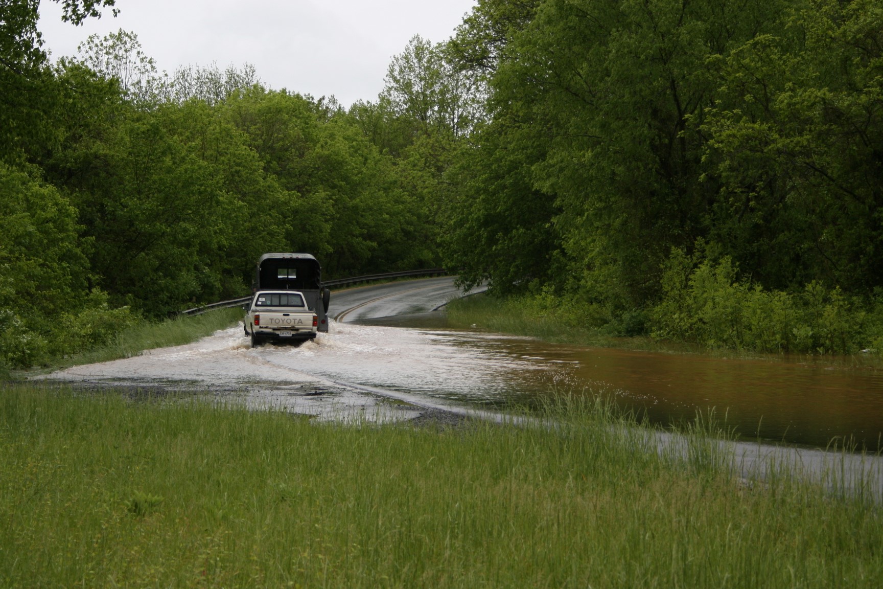
Flash flooding is a type of flooding that is very dangerous and results in more lost lives each year, in the United States, than any other weather phenomena. Flash flooding occurs when intense rains occur in a very short period of time so that the ground can’t absorb the water. Although flash floods usually evolve into river floods, the bigger danger is the rapid rise in water in small streams, creeks, runs and drainage ditches during the intense rainfall. During intense periods of heavy rain, the water in small water drainage areas can rise several feet in a matter of minutes. This results in fast flowing water that can carry cars and people quickly downstream and even wash away buildings in the biggest flash floods. The most serious flash floods usually occur in mountainous areas. The sloped terrain creates even greater runoff and faster rises in streams and rivers. This is what happened in June 1995 in Madison County when rainfall of 20-30 inches fell in about 16 hours. This gets a bit technical, but is a great overview of the Madison County Flash Flood.
There are some things that you can do to protect yourself from flash floods. The first is “DON’T EVER DRIVE YOUR CAR THROUGH WATER THAT’S RUNNING OVER A ROAD”. The danger lies in the fact that the water can eat away at the road and you really don’t know the depth of the water or if the road is washed away. It only takes about 18 inches of water to carry away most cars we drive today. About half of all flash flood deaths are from people in cars that get trapped in flash floods. If you ever come across this situation, “TURN AROUND DON’T DROWN.” Flash floods at night are even more dangerous since your visibility is reduced.
I grew up an Air Force Brat. Traveled the country and lived in Georgia, Maine, New York, Hawaii and Oklahoma.
I fell in love with the weather in Oklahoma. My father was transferred to Tinker AFB in 1973. While in Temporary housing (a mobile home, which is the standard in Oklahoma) I experienced my first severe thunderstorm with strong winds and hail the size of baseballs. The next day I was in the base library looking up books on weather. The rest is history.
I graduated from the University of Oklahoma in 1983 with a Bachelor’s Degree in Meteorology. The first two years we took Calculus, Differential equations, Physics, Chemistry and Computer science classes with the Engineering Students. It was a grind. My degree is actually from the College of Engineering. The last 2-3 year’s focus was on Meteorology including Observational networks (Satellite, Radar, Surface), Physics, Thermodynamics, Dynamics, Synoptic, Winter Weather, Severe Weather and Climatology.
My first job out of college was with a small forecasting company in Oklahoma City. I was immediately put on TV (OETA) and Radio (WKY) as their broadcast Meteorologist. After two years in broadcasting, I decided to pursue the National Weather Service route and got a position in Toledo, OH as an intern. After a couple of years, I was promoted to a forecaster position at the Cleveland Forecast office. I quickly moved into the Weather Preparedness position and was responsible for all the preparedness activities in the state of Ohio.
In 1992 I decided to pursue other forecast opportunities and moved to the Meteorological Operations Division of the National Meteorological Center in Washington, DC. This group is now called WPC (Weather Prediction Center). There I fine-tuned my forecasting of Synoptic Weather with my focus on Heavy Convective Rainfall and Winter Storms, under the supervision of Dr. Louis Uccellini. He has written several books on East Coast Winter storms. I was promoted to a Senior Branch Forecast position during my tenure at MOD. Part of my job was to teach weather classes at COMET (Cooperative Program for Operational Meteorology, Education, and Training).
In 2012 I was given the opportunity to start up a new weather support group with the FAA (Federal Aviation Administration) in Warrenton, VA at the ATCSSC (Air Traffic Control System Command Center). The ATCSCC is where the FAA identifies solutions to air traffic inefficiencies in the NAS (National Air Space) for the CONUS (Continental United State). Weather impacts are the biggest impact on Aviation with yearly losses over 20 billion dollars. My job was to help lower these inefficiencies/costs by providing weather impact briefings and forecasts in order to keep the air planes moving as safely and efficiently as possible.
I retired in 2022 and now am running Lake Anna Weather, LLC.
Subscribe for Updates
Sponsors
latest articles
April 21, 2026
Lake Anna Development Continues: Data Centers, Dominion Updates, Roundabout Plaza, New Golf Course & Phosphorus and Hydrilla Management Reports at the 2026 Lake Anna Summit
April 18, 2026
From Louisa County to Hospital Halls: How Virginia Poodles & Doodles Is Making a Broader Impact
April 15, 2026
Lake Anna Waterfront Property | Custom Lake Home for Sale | Lake Anna, VA
March 18, 2026
Puppy Culture, Playgrounds & Early Foundations: How Virginia Poodles & Doodles Raises Confident Companions [Sponsored]
March 2, 2026
The Lion’s Den 1837 Celebrates First Anniversary With Black Tie Evening of Fine Dining and Jazz
February 27, 2026
Five Decades of Innovation in Fishing, and Boating Sustainability at Lake Anna
Spotsylvania Tourism Growth Outpaces Statewide Averages with 35% Surge Since 2019
SPOTSYLVANIA COUNTY, VA — Visitor spending in Spotsylvania County has soared nearly 35% since 2019, reflecting a strong rebound and…
Article By Jen Bailey
![Featured image for “[Spotsylvania] New Speed Enforcement in School Zones”](https://lakeanna.online/wp-content/uploads/2025/09/Blog-pic-scaled.jpg)
[Spotsylvania] New Speed Enforcement in School Zones
To curb speeding and improve student safety, Spotsylvania officials have announced the launch of an automated speed enforcement program in…
Article By Jen Bailey
Belmont Ruritan Clubs Award $26,000 in Scholarships to Local Seniors
Thirteen outstanding seniors from Louisa, Orange, and Spotsylvania counties were recognized Tuesday evening, June 3, as the Belmont Ruritan Club…