
As we watch in horror the devastating floods in TX over the 4th of July weekend from the remnants of Tropical Storm Barry, and the heavy rainfall from Tropical Storm Chantal, we need to be prepared for the worst as hurricane season is ramping up.
The 2025 names are: Andrea, Barry, Chantal, Dexter, Erin, Fernand, Gabrielle, Humberto, Imelda, Jerry, Karen, Lorenzo, Melissa, Nestor, Olga, Pablo, Rebekah, Sebastien, Tanya, Van, and Wendy.
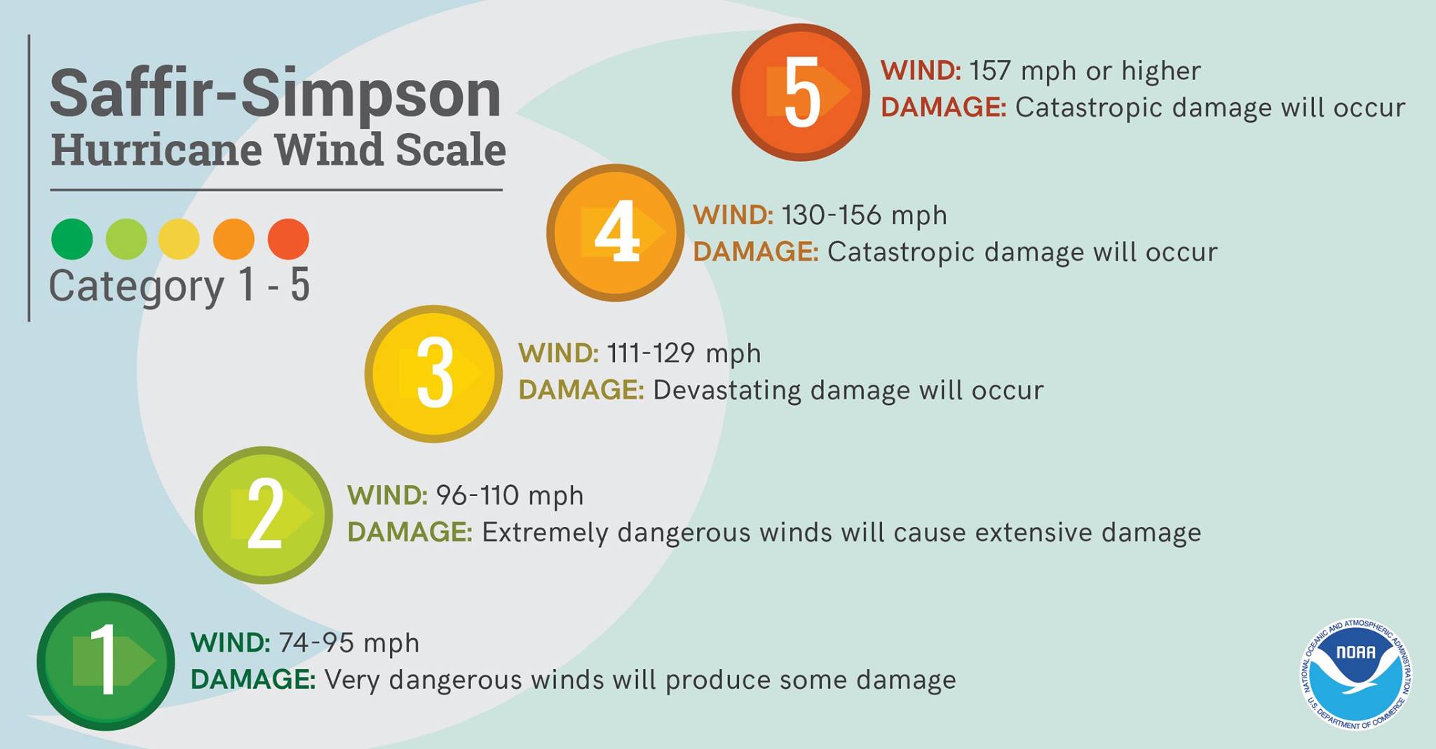
Hurricanes can bring many different types of weather with them as they make landfall. The strong winds are the first thing that comes to mind. Fortunately, the highest winds are always associated with hurricanes near or over ocean waters. Once they move inland, the winds begin to decrease as hurricanes lose the connection to warm ocean waters. This does not mean we can’t get strong winds in Virginia, just that the winds usually will be much weaker once it moves well inland. Hurricane Isabel produced 60–80 mph winds across our region in 2005.
The strong winds also play an important role in raising the level of coastal and tidal river waters, called storm surge. Fortunately, the LKA area is far enough inland so that storm surges can’t affect us. Hurricanes can also bring tornado outbreaks. Virginia’s worst tornado outbreak was in Sep 2004 with the remnants of Hurricane Ivan.
The last and most threatening phenomena from hurricanes, tropical storms, or weakening tropical systems are the heavy rains and ensuing floods/flash floods that follow. This is usually the biggest threat to the LKA area. Rainfall amounts in excess of one foot can occur, especially since we live in an area where the Blue Ridge Mountains tend to increase rainfall amounts and magnify the runoff. The mountains act as a barrier to the moist circulation around a hurricane. Strong easterly or southeast winds blow into the mountain, and the air is mechanically lifted. This supports increased lift, and water vapor is condensed into rain rather quickly. Some of Virginia’s heaviest rains have come from the remnants of hurricanes.
In August 1969, the remnants of Hurricane Camille brought severe flooding to the Blue Ridge south of Charlottesville. Up to 31 inches of rain fell in 12 hours with devastating results. The ensuing flash flood and mudslide are estimated to have killed 153 people (not all the bodies were found). Most died in Nelson County.
In June 1972, the remnants of Hurricane Agnes moved into Virginia and produced 1–2 feet of rain that turned rivers and streams into raging torrents. Lake Anna was near completion, and the runoff was a major contributor to filling the lake well before it was supposed to be filled.
The state of Virginia has set up a web page with lots of other useful information relating to hurricanes. This can be seen at https://www.vaemergency.gov/threats/hurricanes. You can follow the tropical season forecasts from the National Hurricane Center at https://www.nhc.noaa.gov/.

I grew up an Air Force Brat. Traveled the country and lived in Georgia, Maine, New York, Hawaii and Oklahoma.
I fell in love with the weather in Oklahoma. My father was transferred to Tinker AFB in 1973. While in Temporary housing (a mobile home, which is the standard in Oklahoma) I experienced my first severe thunderstorm with strong winds and hail the size of baseballs. The next day I was in the base library looking up books on weather. The rest is history.
I graduated from the University of Oklahoma in 1983 with a Bachelor’s Degree in Meteorology. The first two years we took Calculus, Differential equations, Physics, Chemistry and Computer science classes with the Engineering Students. It was a grind. My degree is actually from the College of Engineering. The last 2-3 year’s focus was on Meteorology including Observational networks (Satellite, Radar, Surface), Physics, Thermodynamics, Dynamics, Synoptic, Winter Weather, Severe Weather and Climatology.
My first job out of college was with a small forecasting company in Oklahoma City. I was immediately put on TV (OETA) and Radio (WKY) as their broadcast Meteorologist. After two years in broadcasting, I decided to pursue the National Weather Service route and got a position in Toledo, OH as an intern. After a couple of years, I was promoted to a forecaster position at the Cleveland Forecast office. I quickly moved into the Weather Preparedness position and was responsible for all the preparedness activities in the state of Ohio.
In 1992 I decided to pursue other forecast opportunities and moved to the Meteorological Operations Division of the National Meteorological Center in Washington, DC. This group is now called WPC (Weather Prediction Center). There I fine-tuned my forecasting of Synoptic Weather with my focus on Heavy Convective Rainfall and Winter Storms, under the supervision of Dr. Louis Uccellini. He has written several books on East Coast Winter storms. I was promoted to a Senior Branch Forecast position during my tenure at MOD. Part of my job was to teach weather classes at COMET (Cooperative Program for Operational Meteorology, Education, and Training).
In 2012 I was given the opportunity to start up a new weather support group with the FAA (Federal Aviation Administration) in Warrenton, VA at the ATCSSC (Air Traffic Control System Command Center). The ATCSCC is where the FAA identifies solutions to air traffic inefficiencies in the NAS (National Air Space) for the CONUS (Continental United State). Weather impacts are the biggest impact on Aviation with yearly losses over 20 billion dollars. My job was to help lower these inefficiencies/costs by providing weather impact briefings and forecasts in order to keep the air planes moving as safely and efficiently as possible.
I retired in 2022 and now am running Lake Anna Weather, LLC.
Subscribe for Updates
Sponsors


latest articles
April 21, 2026
Lake Anna Development Continues: Data Centers, Dominion Updates, Roundabout Plaza, New Golf Course & Phosphorus and Hydrilla Management Reports at the 2026 Lake Anna Summit
April 18, 2026
From Louisa County to Hospital Halls: How Virginia Poodles & Doodles Is Making a Broader Impact

April 15, 2026
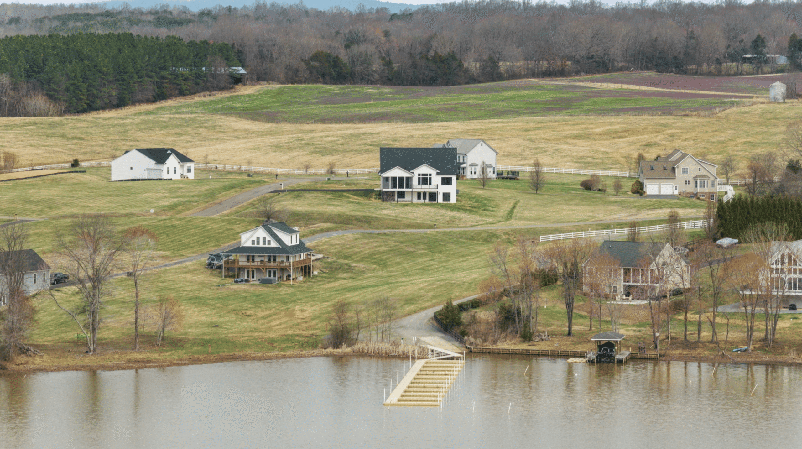
Lake Anna Waterfront Property | Custom Lake Home for Sale | Lake Anna, VA
March 18, 2026
Puppy Culture, Playgrounds & Early Foundations: How Virginia Poodles & Doodles Raises Confident Companions [Sponsored]
![Featured image for “Puppy Culture, Playgrounds & Early Foundations: How Virginia Poodles & Doodles Raises Confident Companions [Sponsored]”](https://lakeanna.online/wp-content/uploads/2026/02/3-scaled.jpg)
March 2, 2026
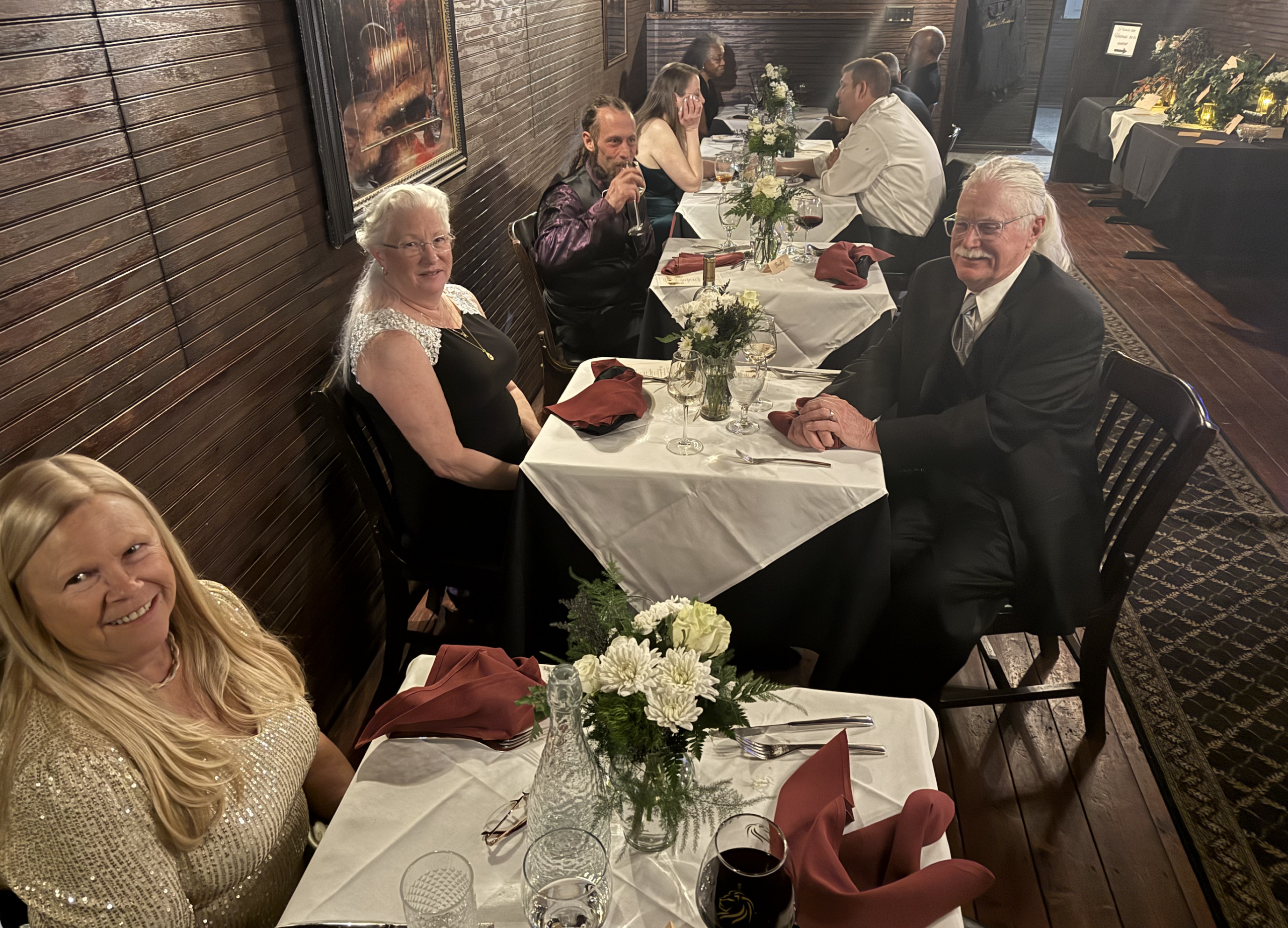
The Lion’s Den 1837 Celebrates First Anniversary With Black Tie Evening of Fine Dining and Jazz
February 27, 2026
Five Decades of Innovation in Fishing, and Boating Sustainability at Lake Anna
As we watch in horror the devastating floods in TX over the 4th of July weekend from the remnants of Tropical Storm Barry, and the heavy rainfall from Tropical Storm Chantal, we need to be prepared for the worst as hurricane season is ramping up.
The 2025 names are: Andrea, Barry, Chantal, Dexter, Erin, Fernand, Gabrielle, Humberto, Imelda, Jerry, Karen, Lorenzo, Melissa, Nestor, Olga, Pablo, Rebekah, Sebastien, Tanya, Van, and Wendy.
Hurricanes can bring many different types of weather with them as they make landfall. The strong winds are the first thing that comes to mind. Fortunately, the highest winds are always associated with hurricanes near or over ocean waters. Once they move inland, the winds begin to decrease as hurricanes lose the connection to warm ocean waters. This does not mean we can’t get strong winds in Virginia, just that the winds usually will be much weaker once it moves well inland. Hurricane Isabel produced 60–80 mph winds across our region in 2005.
The strong winds also play an important role in raising the level of coastal and tidal river waters, called storm surge. Fortunately, the LKA area is far enough inland so that storm surges can’t affect us. Hurricanes can also bring tornado outbreaks. Virginia’s worst tornado outbreak was in Sep 2004 with the remnants of Hurricane Ivan.
The last and most threatening phenomena from hurricanes, tropical storms, or weakening tropical systems are the heavy rains and ensuing floods/flash floods that follow. This is usually the biggest threat to the LKA area. Rainfall amounts in excess of one foot can occur, especially since we live in an area where the Blue Ridge Mountains tend to increase rainfall amounts and magnify the runoff. The mountains act as a barrier to the moist circulation around a hurricane. Strong easterly or southeast winds blow into the mountain, and the air is mechanically lifted. This supports increased lift, and water vapor is condensed into rain rather quickly. Some of Virginia’s heaviest rains have come from the remnants of hurricanes.
In August 1969, the remnants of Hurricane Camille brought severe flooding to the Blue Ridge south of Charlottesville. Up to 31 inches of rain fell in 12 hours with devastating results. The ensuing flash flood and mudslide are estimated to have killed 153 people (not all the bodies were found). Most died in Nelson County.
In June 1972, the remnants of Hurricane Agnes moved into Virginia and produced 1–2 feet of rain that turned rivers and streams into raging torrents. Lake Anna was near completion, and the runoff was a major contributor to filling the lake well before it was supposed to be filled.
The state of Virginia has set up a web page with lots of other useful information relating to hurricanes. This can be seen at https://www.vaemergency.gov/threats/hurricanes. You can follow the tropical season forecasts from the National Hurricane Center at https://www.nhc.noaa.gov/.
I grew up an Air Force Brat. Traveled the country and lived in Georgia, Maine, New York, Hawaii and Oklahoma.
I fell in love with the weather in Oklahoma. My father was transferred to Tinker AFB in 1973. While in Temporary housing (a mobile home, which is the standard in Oklahoma) I experienced my first severe thunderstorm with strong winds and hail the size of baseballs. The next day I was in the base library looking up books on weather. The rest is history.
I graduated from the University of Oklahoma in 1983 with a Bachelor’s Degree in Meteorology. The first two years we took Calculus, Differential equations, Physics, Chemistry and Computer science classes with the Engineering Students. It was a grind. My degree is actually from the College of Engineering. The last 2-3 year’s focus was on Meteorology including Observational networks (Satellite, Radar, Surface), Physics, Thermodynamics, Dynamics, Synoptic, Winter Weather, Severe Weather and Climatology.
My first job out of college was with a small forecasting company in Oklahoma City. I was immediately put on TV (OETA) and Radio (WKY) as their broadcast Meteorologist. After two years in broadcasting, I decided to pursue the National Weather Service route and got a position in Toledo, OH as an intern. After a couple of years, I was promoted to a forecaster position at the Cleveland Forecast office. I quickly moved into the Weather Preparedness position and was responsible for all the preparedness activities in the state of Ohio.
In 1992 I decided to pursue other forecast opportunities and moved to the Meteorological Operations Division of the National Meteorological Center in Washington, DC. This group is now called WPC (Weather Prediction Center). There I fine-tuned my forecasting of Synoptic Weather with my focus on Heavy Convective Rainfall and Winter Storms, under the supervision of Dr. Louis Uccellini. He has written several books on East Coast Winter storms. I was promoted to a Senior Branch Forecast position during my tenure at MOD. Part of my job was to teach weather classes at COMET (Cooperative Program for Operational Meteorology, Education, and Training).
In 2012 I was given the opportunity to start up a new weather support group with the FAA (Federal Aviation Administration) in Warrenton, VA at the ATCSSC (Air Traffic Control System Command Center). The ATCSCC is where the FAA identifies solutions to air traffic inefficiencies in the NAS (National Air Space) for the CONUS (Continental United State). Weather impacts are the biggest impact on Aviation with yearly losses over 20 billion dollars. My job was to help lower these inefficiencies/costs by providing weather impact briefings and forecasts in order to keep the air planes moving as safely and efficiently as possible.
I retired in 2022 and now am running Lake Anna Weather, LLC.
Subscribe for Updates
Sponsors
latest articles
April 21, 2026
Lake Anna Development Continues: Data Centers, Dominion Updates, Roundabout Plaza, New Golf Course & Phosphorus and Hydrilla Management Reports at the 2026 Lake Anna Summit
April 18, 2026
From Louisa County to Hospital Halls: How Virginia Poodles & Doodles Is Making a Broader Impact
April 15, 2026
Lake Anna Waterfront Property | Custom Lake Home for Sale | Lake Anna, VA
March 18, 2026
Puppy Culture, Playgrounds & Early Foundations: How Virginia Poodles & Doodles Raises Confident Companions [Sponsored]
March 2, 2026
The Lion’s Den 1837 Celebrates First Anniversary With Black Tie Evening of Fine Dining and Jazz
February 27, 2026
Five Decades of Innovation in Fishing, and Boating Sustainability at Lake Anna
Spotsylvania Tourism Growth Outpaces Statewide Averages with 35% Surge Since 2019
SPOTSYLVANIA COUNTY, VA — Visitor spending in Spotsylvania County has soared nearly 35% since 2019, reflecting a strong rebound and…
Article By Jen Bailey
![Featured image for “[Spotsylvania] New Speed Enforcement in School Zones”](https://lakeanna.online/wp-content/uploads/2025/09/Blog-pic-scaled.jpg)
[Spotsylvania] New Speed Enforcement in School Zones
To curb speeding and improve student safety, Spotsylvania officials have announced the launch of an automated speed enforcement program in…
Article By Jen Bailey
Belmont Ruritan Clubs Award $26,000 in Scholarships to Local Seniors
Thirteen outstanding seniors from Louisa, Orange, and Spotsylvania counties were recognized Tuesday evening, June 3, as the Belmont Ruritan Club…